Category:'s-Gravensloot
Jump to navigation
Jump to search
former municipality in the Dutch province of Utrecht   | |||||
| Upload media | |||||
| Instance of |
| ||||
|---|---|---|---|---|---|
| Location | |||||
| Population | |||||
 | |||||
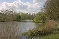
's-Gravensloot. Een prachtig landelijk buurtschap grenzend direct ten noorden van de stad Woerden in de provincie Utrecht in Nederland. Het buurtschap ligt in de gemeente Utrecht maar het behoort voor de post in het dorp Kamerik.
Media in category "'s-Gravensloot"
The following 13 files are in this category, out of 13 total.
-
 's-Gravensloot een mooi buurtschap direct ten noorden van Woerden.jpg 4,770 × 3,177; 2.77 MB
-
 's-Gravensloot een prachtig buurtschap dat behoort aan Kamerik.jpg 4,770 × 3,177; 3.1 MB
-
 's-Gravensloot het zeer landelijke buurtschap bij de stad Woerden.jpg 4,770 × 3,177; 3.19 MB
-
 's-Gravensloot, direct aan het begin van het buurtschap zien we dit bord.jpg 1,748 × 1,818; 808 KB
-
 's-Gravensloot, het buurtschap ten noorden van Woerden.jpg 4,770 × 3,177; 3.26 MB
-
 Aan het begin van 's-Gravensloot in het mooie Brediuspark van Woerden.jpg 4,770 × 3,177; 3.71 MB
-
 De bijzondere dwarshuisboerderij "Buitenlust" in 's-Gravensloot.jpg 4,770 × 3,177; 3.39 MB
-
 De Oude Rijn ter hoogte van 's-Gravensloot bij Woerden.jpg 4,770 × 3,177; 2.64 MB
-
 Het Lignepad bij 's-Gravensloot gaat hier de weide polder in.jpg 4,770 × 3,177; 2.96 MB
-
 Het water de Grecht ter hoogte van 's-Gravensloot bij Woerden.jpg 4,770 × 3,177; 2.62 MB
-
 Het zelfbedienings pontje over de Grecht bij 's-Gravensloot.jpg 5,120 × 3,072; 1.46 MB
-
 Hte buurtje De Hoogge Boom direct gelegen aan het water van de Grecht.jpg 4,770 × 3,177; 2.49 MB
-
 Prachtig gelegen streekeigen boerderij in het vroeg voorjaar in 's-Gravensloot.jpg 4,770 × 3,177; 3.74 MB


